In the last years of the twentieth century, regionalism became a key concept for all kinds of aspirations. In particular, the program of ‘critical regionalism’ proposed by American art historian Kenneth Frampton stirred the minds of architects and significantly influenced the architecture of the 1980s and ’90s. Friedrich Achleitner, Viennese writer and architectural critic, believes the concept of ‘region’ – along with those of ‘homeland’ and ‘nation’ – to be potentially dangerous because all three can be manipulated, used and abused by various ideologies. He argues that the term ‘region’ could justify exclusion, devaluation and even defamation and discrimination.1
In Europe, the concept of regions has gained popularity in the context of discussions on the European Union, as it could contribute to supporting the idea of the independence of certain areas. Particularly in the 1980s, there was debate about the growing role of regions such as the Basque Country, South Tyrol or Brittany within the federalist administration of the European Union. As soon as state borders lose their importance, regions will have the chance to gain independence and strength – it was said at the time – because they will have the opportunity to develop a more competent and better functioning administration, they will become more competitive and will reduce the distance from their citizens.
In 1985, the Assembly of European Regions was established. This organization currently brings together 250 regions from 30 European countries. The principle of subsidiarity remains inseparable from the popular “synesthetic” regionalism: the region has been discovered as an inexhaustible source of sensory experiences, provided by tourism, local wines and exquisite restaurants. Regionalism understood in this way is in contradiction to the concept of Europe that is managed from Brussels. Instead of the efficient administration and standards regulating the angle at which a banana bends, we find a patchwork of moods and aromas. Of course, old dreams of independence and territorial claims do exist, lying dormant under the blanket of regionalism, as demonstrated by the examples of Flanders or Scotland.
Local politicians have begun to redefine the areas – attractive from the point of view of industry, trade, or tourism – which, precisely because of their convenient locations, spanning across state borders, show exceptional growth dynamics. In this way, the so-called Blue Banana came about – a densely populated European area with a high-level technological development extending from the Netherlands to the industrial district of Milan. In 2002, the Dutch architectural firm MVRDV, with pragmatic and ironical flair, created the Regionmaker software, which allows the user to determine the specific identity of any given area, using a set of parameters determined and analysed numerically.2
And yet, this perception of the region – namely, the result of successful cooperation and marketing – seems to clash with another definition of that notion: an identity, built on specific relationships between the geographic location and the culture of the given territory. A summary of the major theses of artistic geography, which flourished in German literature in the field of art history in the 1920s and ’30s, would go beyond this definition of the region.3 Since the late nineteenth century, the humanities have sought to describe regionalism and the “landscapes of art”. In these descriptions, the landscape, climatic conditions, language, folk customs as well as regional culture and art make up an organic whole. Architecture constitutes an important element thereof, because climate and geographic location are directly related to local construction materials, structural types, and architectural forms.
In the 1960s, after a break of about thirty years, a new generation of art historians reraised the question about the distinctiveness of artistic regions (albeit without any propagandist or nationalist undertones). It is worth mentioning the texts by Paul Pieper, Harald Keller and Reiner Haussherr. Jan Białostocki used the concept of the region in a similar way, in his seminal article Obszar nadbałtycki jako region artystyczny w XVI w. [The Baltic area as an artistic region in the sixteenth century].4 Białostocki defines the region not as an intra-national unit, but a supranational one, crossing the borders of individual countries. He is not concerned with the “national spirit”, but with a common starting point, the identical landscape and material conditions, as well as the same social background.
The concept of the region has gained new potential thanks to the spatial turn concept, derived from neogeography. In his works, Marxist philosopher and sociologist Henri Lefebvre described how space is produced as a social form – notably in La production de l’espace5. He distinguished three poles of a trialectic relationship: spatial practice – in terms of the living space, the territory that the person encounters physically, directly, in which they live and which they shape; representations of space – signifying its portrayal through images, plans and sketches, which imply the readability of space. The latter is also a conceptual level (relating to thought) – the level of architectural and urban design. The third element Lefevbre distinguishes is the representational (unreal) space. By this he means places such as a cathedral or an agora, which gain social significance not through space in practice or representation, but by the force of symbols associated with them, which give rise to a specific imagined space. The concept of a region is shaped by these three elements of space: spatial practice, representations of space, and the representational spaces. Expressions such as “Alpine region” indicate that geographical, historical and cultural conditions, similarities and utopias (e.g. Alpine Architektur by Bruno Taut6) affect us to this day.
In his 1979 book Genius loci7 , Norwegian art historian Christian Norberg-Schulz proposed a phenomenological view of places and landscapes. He referred to the Heideggerian differentiation between space and place (Raum und Ort8 ), but went on to propose a more rigid, rigorous definition of the region, based directly on the term genius loci, which goes back to Antiquity. It denotes the “spirit that rules the place”, that is a concrete – even if mythological – reality confronted by man in everyday life. The existence of the “spirit of the place” provides the architect with guidelines: architecture means “visualizing the genius loci, and the architect’s job is to help people, by designing a meaningful place of inhabitation for them.”9
A region’s geography plays an important role in the beliefs of its inhabitants about their identity, especially in the case of imagined regions. In this mythical geography, space is not homogeneous, but it consists of specific places. Ernst Cassirer wrote in his Philosophie der symbolischen Formen about the “typical perception of reality,” through which all kinds of existence possess their “homeland” within space – elements of an all-encompassing cosmic system.10
The cardinal points – east, west, north and south – play a significant role in the definition of identity; they are rooted in the value system.11 The concept of homeland derives from this cultural division of the universe. Land cultivation, the social, economic, administrative, military and cultural structures of the homeland, all remain inseparable from the native mythical geography. The latter also affects the infrastructure of the region. We look after our monuments, and protect our nature. We take care of material culture objects that confirm the truth of local myths. Archaeology is of great importance, because its task is to provide evidence.
Mountain travellers described the geological formations they visited. These natural forms influenced nineteenth-century architectural thinking. John Ruskin was interested in the world of plants and minerals, as evidenced by his drawings and watercolours from his travels in the Swiss Alps. He considered geological formations to be insights into the sublime writing of nature, the work of divine creation.
In the nineteenth century, the local regional landscape proved to be an important source of inspiration for the paintings and metaphors of local art in the United States of America. Rather like monuments did in Europe, it played an important role in shaping identity. Urban planners and architects such as Frederick Law Olmsted and Henry Hobson Richardson regarded the fascination with nature and the critique of the big city by Henry David Thoreau and Ralph Waldo Emerson as expressions of identity in the American art of construction, dominated by natural materials, granite and wood. This way of thinking has inspired the search for a national style in many European countries. Especially the Scandinavians saw similarities between their own folklore, discovered on the occasion of travelling to distant villages, and certain American models.12
Regions have come to occupy an extremely important place on the mental map drafted at the turn of the century, providing potential points of resistance to the dangers of progressing modernization – just as in the 1980s, when Kenneth Frampton recognized the region as a potential impediment to globalization; admitting that the latter endangered local architecture through the influence of media images. No wonder, since the existence of the region is closely linked to the development of local infrastructure: the starting point for modernization. Regions have become a field for projecting the fears and hopes of the inhabitants of big cities. The threat was supposedly in the expansion of infrastructure, which could cause the region to “dissolve” and blend in with the state.
There are areas that appear in the geography of the nation as real and imagined at the same time. These include Podhale – the foothills of the Tatras, the Wallachian land in the Beskid mountains, Kalotászeg in Transylvania and the Catalan mountain massif of Montserrat. These are usually mountains or submontane areas along the borders in a strictly geographical sense, but they also play a major role in national mythology; their belonging to one country or another was repeatedly questioned and changed depending on political turns. Regional legends and myths played a legitimizing role. They were important in discussions on identity and national style at the turn of the century. Discovering these lands and documenting the processes taking place therein is inextricably linked to the cult and artistic interpretation of regions.
Regions were considered vulnerable areas, with potential threats coming not only from neighbouring countries, but also from modernization. Geographical barriers protected them from two imagined perils: the enemy, and the railroad or highway. Thanks to the “insular” position in remote, inaccessible valleys, these regions made it possible for organic communities to survive, where unpolluted art and lifestyles were preserved in their original, ancient forms. How fragile an existence it seemed to be. Artists and ethnographers discovering these areas were aware that their own exploring and collecting passion accelerated the erosion of this unpolluted culture. The very process of discovery and description of the region carries the germ of destruction in itself; just as the first ethnologist visiting an unknown tribe in the jungle contributes to its demise. The distinction and specificity of the region should therefore be protected. At the same time, discovering the region is linked to the hope that the “authentic” values of the “dying village” will contribute to a renaissance within the culture of the centre.13
Many painters, architects, artists, and artisans were inspired by folk culture and had their share in collecting and organizing exhibitions of ethnographic artefacts. They received support from the official cultural policy, which significantly influenced the direction of their collecting activities. Sometimes these were retrograde-nostalgic tendencies; but more often the artists interested in exploring and presenting rural culture were part of the avant-garde movement, and believed that the use of folk features would contribute to the creation of a functional art, anchored in everyday life.
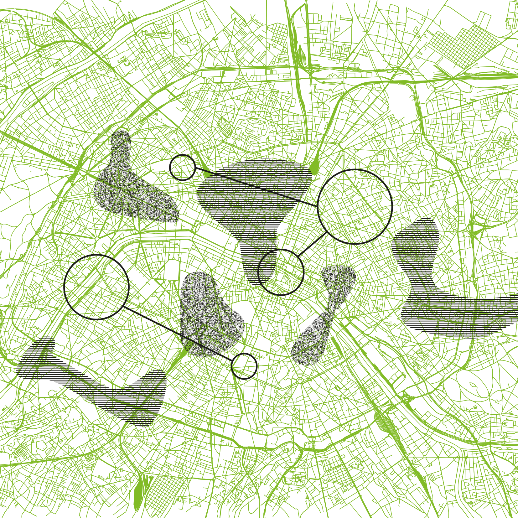
The identity of the region is explored using the same grid of terms as the identity of place. It is about a specific historical aspect, as opposed to the timelessness of space. The Mediterranean region has been described by Fernand Braudel, Georges Duby and Maurice Aymard on the grounds of similarities in climate and atmosphere (sun, rain, dusk) and common history.14 The role of the “cradle of civilization” of the Mediterranean world has rooted it in the past, as the original homeland. It is believed that this habitat is still based on the foundations of community and ritual. It is not difficult to see how this diagnosis of reconciliatory utopia can affect the future of this region. Norberg-Schulz defines genius loci along similar lines as Braudel and his colleagues – the crucial features include the phenomenological criteria of the territory’s properties, its defensive function (to be considered together with the issue of borders), and the possibility of a reasonable orientation. The problem of a region’s cartography can be seen in a broader context when we assume that maps are ideological instruments showing imaginary relationships between the subject and the conditions of its existence. It is precisely this ratio that has become the central, starting point for the analyses of urban tissue, conducted by architect Kevin Lynch.
In his 1976 publication titled Managing the Sense of a Region15 the author seeks to sketch a mental picture (or pictures) of a region – just as in his earlier, more famous work The Image of the City16 he attempted to analyse images created by the various inhabitants of cities. For Lynch, the regions have sensuous or sensory qualities; and he is primarily concerned with examining the visual aspects. For Lynch, the region is – for example – a place that, with the help of building regulations, should be shaped as aesthetically homogeneous. “Regional authorities can provide a coordinated framework for local actions, and level the differences in quality between various groups. They are able, like no other entity, to collect, analyse and disseminate sensory information. Local sensory programs and feasible solutions can be used by local groups, both as a target and as a reference point.”17 Lynch has developed a method known as cognitive mapping, which tracks the relationship between the city’s structure and its representation in the residents’ minds. This is about the connection between a specific, directly perceived environment and the unreal, perceived whole that exists only in the imagination. Lynch uses the interview method, often asking residents to draw sketches of their surroundings; his goal is an ordered city, just as the ideal of a “reasonable place” by Norberg-Schulz, where easy orientation is possible thanks to the clarity and unambiguity of borders (where the tissue of the place ends or breaks), via nodes, monuments and districts. This well-formed place evokes a positive relationship between the cognitive structure of the inhabitants and the “inhabited” area, allowing for orientation, memorization and easy movement around the city.
Even today, Lynch’s cognitive mapping method is used in studying the differences between cognitive maps of various social classes and minorities. In his book Managing the Sense of a Region, Lynch demonstrates that the image of the city as perceived by the black residents of a Los Angeles suburb covers only a few quarters of their nearest neighbourhood; it is only a fraction of the large map of Anglo-Americans living in the middle-class Westwood district. In Lynch’s research, space is understood to be something that has a communicative function, conveying a message. The mental map used by Lynch illustrates the political-spatial system. Its author follows his own ideal of a visually clear environment, easily communicable. The very title, Managing the Sense of a Region, indicates that the authorities should seek to consciously “manage” the region’s sensory values as a spatial system.
Mapping regions is by no means a passive process; instead, it influences reality and organizes the country by projecting a map onto a territory. Therefore, the thesis that the concept of a region constitutes only a rhetorical topos, a spatial articulation of ideas about economics, culture or language, seems far too superficial. Perhaps the most recent examples of that are maps used in Middle Eastern politics.18
The very existence of a regional identity is often questioned today. French ethnologist Marc Augé says that we increasingly often find ourselves in locations such as airport terminals or lobbies, which are completely devoid of any trace of belonging to the territory in which they were built. He calls these locations non-places.19 Also, for the Dutch architect Rem Koolhaas, identity has lost its meaning; he believes that it has become a “mousetrap”. Koolhaas describes “a city without qualities” – a territory consisting of a weave of highways, residential quarters, industrial parks and green spaces, extending like the aforementioned Blue Banana. Recently, the architectural office of the Basel Polytechnic in Zurich (Roger Diener, Jacques Herzog, Marcel Meili, Pierre de Meuron, Christian Schmid), under the influence of Koolhaas, began working on an “urban portrait” of Switzerland with the intention of de-mythologizing the prevailing patterns and criticizing the “culture of avoidance; as well as preventing excessive densification, height, mass, concentration, randomness, and all the other qualities expected of a city.”20 However, there is another idea behind this formulation – to render unto the urban what belongs to the urban.
If we rethink the concept of the region in the historical perspective, we will not only see the search for identity or nationalisms, but also a critical potential. Achleitner writes in his article: “Region-ness and regionalism are expressions of the experience of separation, distance, isolation and an isolationist worldview. Regions can only be experienced through strangeness, differentness, through the new and the unknown.”21 The possibility of shaping this worldview has already been emphasized by Kevin Lynch when he proposed to “manage” the “spirit” of the region. Creative space shaping produces incentives that make it possible to explore the region anew, and to engrave it in the collective consciousness. To program the region according to its specificity – the question remains whether and how the politically “programmed” territories (through branding and other strategies) will turn into “perceived regions”. Or, in other words, what forms of discourse, activity and organization will make the politically conceived profile of the region grow with the place, encourage activity and be appreciated by the locals. In spite of Koolhaas’s assertion, we might still talk about regional identity – though not as a given phenomenon, still awaiting discovery, but as a result of a successful design of the territory.
The text is a record of Ákos Moravánszky’s speech at the Region-Kunst-Regionalismus conference, held on April 1-3, 2005, at the Herder-Institut in Marburg. We would like to thank the Author for his permission to publish.
Translation from Polish: Dorota Wąsik
